ShopDreamUp AI ArtDreamUp
Deviation Actions


Suggested Deviants


Suggested Collections


You Might Like…


Featured in Groups


Description
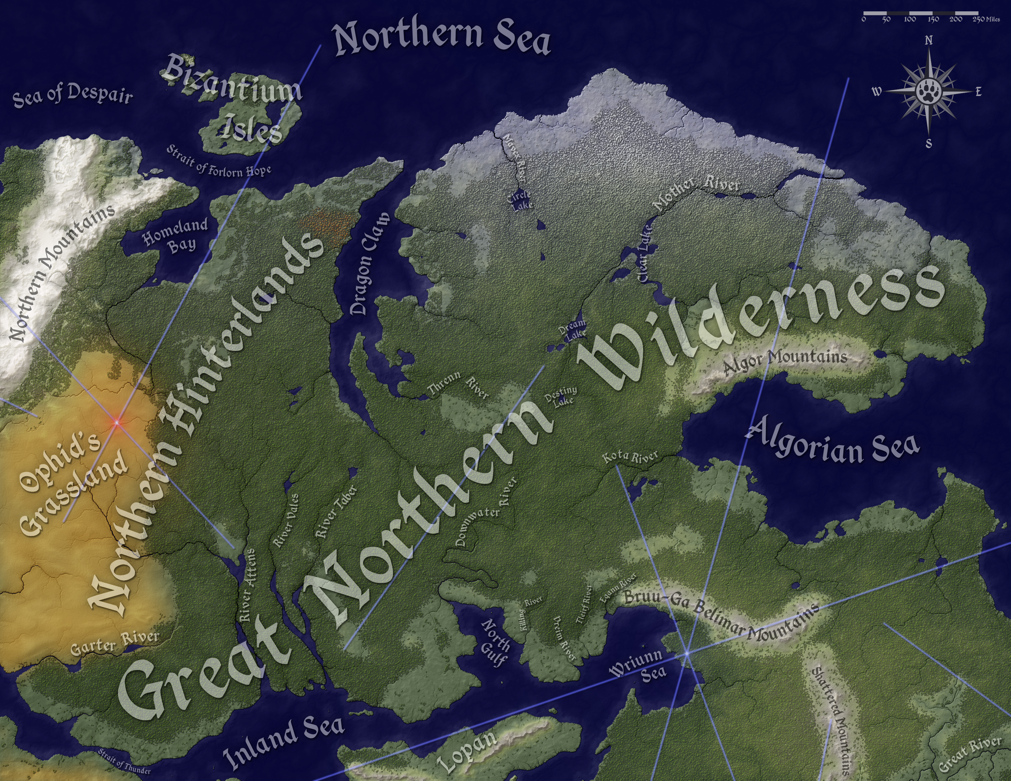
A commission for some avid fans of the Palladium Fantasy Roleplaying Game, this map depicts the single largest region of the known Palladium world, the Great Northern Wilderness. The dominant power in this region is the Wolfen Empire, a new nation originally formed from twelve tribes of the canine humanoids known as the Wolfen.
This version of the map depicts the natural geography of the region, including topography, climate, forests, river/lake systems, and bathymetry. I've also included ley lines and their nexus points (the blue lines and bright spots). Though they are not usually visible in the fantasy world and aren't natural in the strictest sense, they are important geographical features for the magic users and psychics in the game and are essentially forces of nature within this fantasy world.
Other versions available include the full political map and the bare map.
Special thanks to Glen Evans, who has allowed me to include map information from his yet-to-be-published manuscript on the Inland Sea, its islands, and the surrounding coast. I'm also working with him to create a much larger map of the Inland Sea to support his work. Also, thanks to the members of Palladium Message Board who have been following the development of this map and providing very helpful input. Finally, thanks to Arsheesh. Most of my techniques are variations off his tutorials, and if you haven't checked out his gallery, you should.
As a rule, I try to work in new techniques to my map-making process, and this map is no exception. The first new technique I tried is a method for depicting the sea floor and its texture. After a lot of experimentation in previous maps, I've developed a method which creates coastal shadows and deeper waters in a way that doesn't take an unreasonable amount of time and yields results that I'm happy with. I might write up a tutorial for this method later. The second new technique was to include snow-covered forests to correspond with the tundra climate in the far north.
I'm also working on a version of this map that will show the political geography of the areas depicted. I hope to have it finished and posted sometime in the next few weeks.
Palladium Books owns the copyright to Palladium Fantasy and the books that describe the contents of this map. Please do not use any part of this creation for any commercial purposes (unless you work for Palladium Books, in which case, please send me a PM).
Image size
3300x2550px 14.44 MB
© 2016 - 2024 Will-Erwin
Comments5
Join the community to add your comment. Already a deviant? Log In
excellent!